Things to see and do - Karumba
-
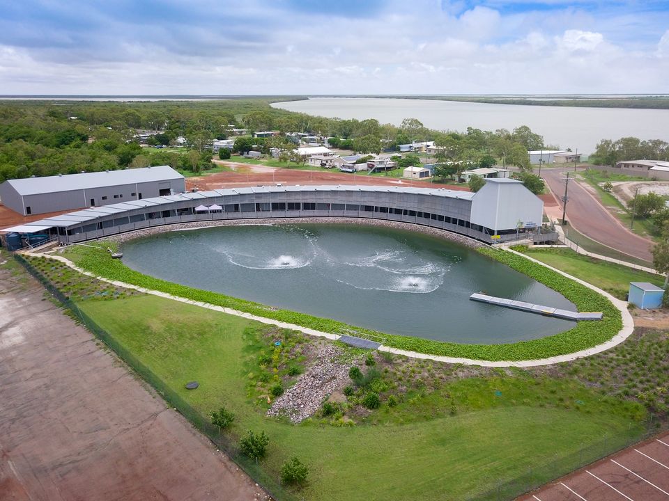
The Les Wilson Barramundi Discovery Centre is an interactive, state of the art facility that provides the history, stories, lifecycle, and habits of one of the most sought-after fish, the barramundi. Take a guided tour, visit the hatchery, feed a barra, or relax by the saltwater lagoon displaying flora and fauna straight from the Norman River. www.barracentre.com.au
149 Yappar Street, Karumba
-
The town's only water supply was from the artesian bore until 1988 when sulphuric content was deemed unsafe for consumption. The metal A-frame standing behind the fire station is all that remains now.
-
This beautiful example of South African architecture was built originally as a radio control facility for the flying boats, owned and operated by Qantas and the British Airways. The entire complex block became the base for the 43rd squadron, flying operational patrols in World War II.
-
There are several Boat Cruises on offer in Karumba for recreational fishing, crabbing, crocodile spotting and bird watching. It's the perfect way to learn about our unique area with the knowledgeable tour guides.
-
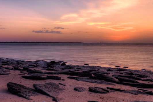
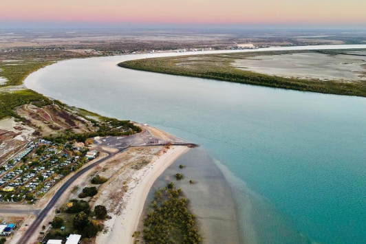
Karumba Point Beach is the only beach in the Gulf of Carpentaria that is accessible by bitumen road. Enjoy walking along the beachfront and watching the sunset over the Gulf of Carpentaria. Picnic tables and amenities are also available, while relaxing watching the sunset or fishing.
-
Krystina and Ron were famous crocodile shooters in the 1950s. Karumba Point Service Station now stands where Krystina and Ron in 1965, the couple started Australia's first crocodile farm in Karumba, but were eventually forced to close.
-
The first live cattle transported from Karumba were in 1900. Export ceased during WWII and then started exporting again in the 1950s. Still until today cattle are exported regular in the dry season to Indonesia, Philippines, Papua New Guinea and Vietnam. There is no access to this facility.
-
Shannon Bros built a meat works on this site, it lasted two years before going into liquidation. AW Anderson 'The Sausage King' bought it and continued meat works. It burnt down in the 1950s and was converted into a prawn processing plant. A. Raptis & Sons bought it in 1977.
-
This small brick building was originally an oil and foam storage facility for the flying boats. The foam was to extinguish fires by running a hose down to the boat ramp if a fire accrued. Another larger rounded brick structure behind this building was used for fuel storage.
-
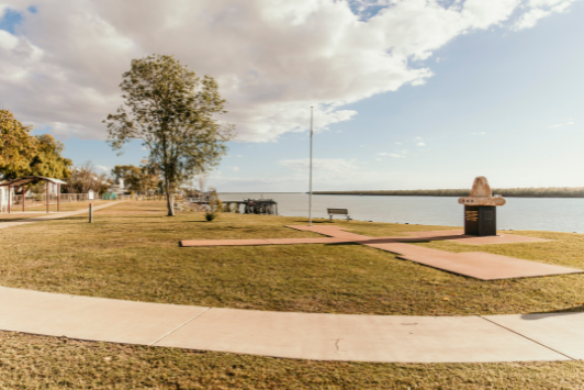
The towns Cenotaph is here looking out at the Norman River. Beautiful scenery of the boats, wharf and the Norman River can be viewed here. Point: Karumba heritage walk is a chance to find out more about Karumba and surrounds. This walk also incorporates linking town and the Point.
-
This large concrete pad was built by the Royal Australian Air Force (RAAF) as a spillway in the early 1940s to get Catalina and the Short Sunderland aircraft in and out of the water. Catalina photo gallery is situated at Carpentaria Fuels.
-
The Norman Mouth, as it was originally known, changed to Kimberly and later to stop confusion with Kimberly in the Northern Territory it was changed again to Karumba believed to be an aboriginal word meaning 'Spirit of an old man'.
-
Karumba, the home of the most awe-inspiring sunrises, especially if your visit is timed to coincide with the morning glory clouds. The Gulf is the only place on earth where morning glory clouds can be predicted and observed on a regular basis. The best time of year to capture this event is during September to November. Stop anywhere between Karumba and Burketown.
-
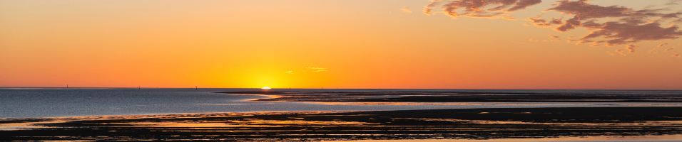
The sky lights up as the sun sets in the Gulf of Carpentaria, where you have a front row seat to the sea of stars illuminating the night sky. Don’t forget to add the hashtags #gulfcountry and #outbackbythesea when you make everyone jealous sharing on social media.
-
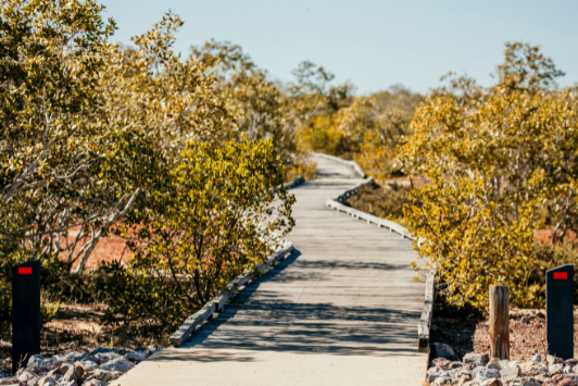
This pathed walk is a chance to discover the history of Karumba and its surroundings. The walk is a 4km track between Karumba town and Karumba Point and includes many boardwalks for photographers and birdwatchers to capture stunning scenery, wildlife and sunsets.
-
Located 30km off the coast of Burketown, Sweers Island is an untouched paradise. Experience the golden beaches, history, and abundant birdlife as you relax and unwind. The island is fisherman’s paradise and offers something for the whole family.
Note: access to the island must be made by the individual as no commercial service is currently available. Alcohol is banned on Sweers Island outside of the resort.